logo
Product categories

EbookNice.com

Most ebook files are in PDF format, so you can easily read them using various software such as Foxit Reader or directly on the Google Chrome browser.
Some ebook files are released by publishers in other formats such as .awz, .mobi, .epub, .fb2, etc. You may need to install specific software to read these formats on mobile/PC, such as Calibre.

Please read the tutorial at this link.  https://ebooknice.com/page/post?id=faq


We offer FREE conversion to the popular formats you request; however, this may take some time. Therefore, right after payment, please email us, and we will try to provide the service as quickly as possible.


For some exceptional file formats or broken links (if any), please refrain from opening any disputes. Instead, email us first, and we will try to assist within a maximum of 6 hours.

EbookNice Team
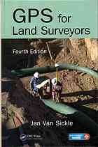
(Ebook) GPS for land surveyors 1st Edition by Jan Van Sickle ISBN 146658310X 9781466583108

  • SKU: EBN-9953118
Zoomable Image
$ 32 $ 40 (-20%)

Status:

Available

4.8

12 reviews
Instant download (eBook) GPS for land surveyors after payment.
Authors:Van Sickle, Jan
Pages:349 pages.
Year:2015
Editon:4rd edition
Publisher:CRC Press Taylor & Francis Group
Language:english
File Size:11.33 MB
Format:pdf
ISBNS:9781466583108, 146658310X
Categories: Ebooks

Product desciption

(Ebook) GPS for land surveyors 1st Edition by Jan Van Sickle ISBN 146658310X 9781466583108

(Ebook) GPS for land surveyors 1st Edition by Jan Van Sickle - Ebook PDF Instant Download/Delivery: 146658310X, 9781466583108
Full download (Ebook) GPS for land surveyors 1st Edition after payment

Product details:

ISBN 10: 146658310X 
ISBN 13: 9781466583108
Author: Jan Van Sickle

For more than a decade, GPS for Land Surveyors has been unique among other books on this topic due to its clear, straightforward treatment of the subject matter. Completely revised and updated, this fourth edition of a perennial bestseller maintains the user-friendly format that made previous editions so popular while addressing changes in hardware, software, and procedures. Neither simplistic nor overly technical, this book introduces the concepts needed to understand and use GPS and Global Navigation Satellite Systems (GNSS). See What's New in the Fourth Edition: Up-to-date information on GNSS and GPS modernization Changes in hardware, software, and procedures Comprehensive treatment of novel signals on new blocks of satellites (L5 and L2C) The book minimizes your reliance on mathematical explanations and maximizes use of illustrations and examples that allow you to visualize and grasp key concepts. The author explains the progression of ideas at the foundation of satellite positioning and delves into some of the particulars. He keeps presentation practical, providing a guide to techniques used in GPS, from their design through observation, processings, real-time kinematic (RTK), and real-time networks. These features and more make it easier for you to meet the challenge of keeping up in this field.

(Ebook) GPS for land surveyors 1st Table of contents:

  1. Global Positioning System (GPS) Signal

  2. GPS Signal Structure

  3. Two Observables

  4. Pseudoranging

  5. Carrier Phase Ranging

  6. Biases and Solutions

  7. Biases

  8. Receiver Noise

  9. Solutions

  10. Summary Framework

  11. Technological Forerunners

  12. GPS Segments

  13. GPS Constellation

  14. Receivers and Methods

  15. Common Features of GPS Receivers

  16. Coordinates

  17. Geodetic Datums for GPS

  18. State Plane Coordinates

  19. Heights

  20. Static GPS Surveying

  21. Planning

  22. NGS Control

  23. Continuously Operating Networks

  24. Static Survey Project Design

  25. Preparation

  26. GPS Survey Design Facts

  27. Drawing the Baselines

  28. Static GPS Control Observations

  29. Real-Time GPS Surveying

  30. RTK and DGPS

  31. Radial GPS

  32. DGPS

  33. Local and Wide Area DGPS

  34. GIS Application

  35. Integer Cycle Ambiguity Fixing

  36. Wireless Link

  37. Vertical Component in RTK

  38. Practical RTK Suggestions

  39. Real-Time Network Services

  40. Real-Time GPS Techniques

  41. Precise Point Positioning (PPP)

  42. GPS Modernization and GNSS

  43. GPS Modernization

  44. Satellite Blocks

  45. Power Spectral Density Diagrams

  46. New Signals

  47. GNSS

  48. GLONASS

  49. Galileo

  50. Interoperability of GPS, GLONASS, and Galileo

  51. BeiDou

  52. QZSS

  53. IRNSS

  54. The Future

  55. Interoperability

  56. Glossary

People also search for (Ebook) GPS for land surveyors 1st:


gps for land surveyors pdf
    
gps for land surveyors 4th edition pdf
    
gps for land surveyors 4th edition
    
gps for land surveyors
    
gps for land surveyors book
    
gps tracker for land surveyors


Tags: Jan Van Sickle, GPS, surveyors

*Free conversion of into popular formats such as PDF, DOCX, DOC, AZW, EPUB, and MOBI after payment.

Related Products