logo
Product categories

EbookNice.com

Most ebook files are in PDF format, so you can easily read them using various software such as Foxit Reader or directly on the Google Chrome browser.
Some ebook files are released by publishers in other formats such as .awz, .mobi, .epub, .fb2, etc. You may need to install specific software to read these formats on mobile/PC, such as Calibre.

Please read the tutorial at this link.  https://ebooknice.com/page/post?id=faq


We offer FREE conversion to the popular formats you request; however, this may take some time. Therefore, right after payment, please email us, and we will try to provide the service as quickly as possible.


For some exceptional file formats or broken links (if any), please refrain from opening any disputes. Instead, email us first, and we will try to assist within a maximum of 6 hours.

EbookNice Team
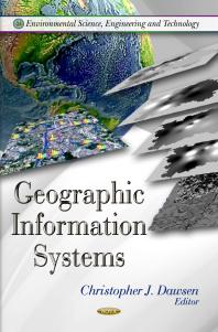
(Ebook) Geographic Information Systems by Christopher J. Dawsen ISBN 9781620819050, 1620819058

  • SKU: EBN-51369338
Zoomable Image
$ 32 $ 40 (-20%)

Status:

Available

4.5

25 reviews
Instant download (eBook) Geographic Information Systems after payment.
Authors:Christopher J. Dawsen
Pages:167 pages.
Year:2011
Editon:1
Publisher:Nova Science Publishers, Incorporated
Language:english
File Size:11.58 MB
Format:pdf
ISBNS:9781620819050, 1620819058
Categories: Ebooks

Product desciption

(Ebook) Geographic Information Systems by Christopher J. Dawsen ISBN 9781620819050, 1620819058

A geographic information system (GIS) is any system that captures, stores, analyzes, manages and presents data that are linked to locations. In the simplest terms, GIS is the merging of cartography, statistical analysis and database technology, and can be used in archaeology, geography, cartography, remote sensing, land surveying, public utility management and natural resource management. This new book presents topical research in the study of GIS, including GIS in the spatial decision making process; GIS for wide-range species conservation planning and forestry; GIS in rainwater harvesting, estimating the environmental effects on residential property and traffic-related environmental pollution in the GIS.
*Free conversion of into popular formats such as PDF, DOCX, DOC, AZW, EPUB, and MOBI after payment.

Related Products