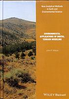
(Ebook) Environmental applications of digital terrain modeling by Wilson, John Peter ISBN 9781118936207, 9781118936214, 9781118938171, 9781118938188, 1118936205, 1118936213, 1118938178, 1118938186
"This book examines how the methods and data sources used to generate DEMs and calculate land surface parameters have changed over the past 25 years. The primary goal is to describe the state-of-the-art for a typical digital terrain modeling workflow that starts with data capture, continues with data preprocessing and DEM generation, and concludes with the calculation of one or more primary and secondary land
surface parameters. The book describes some of ways in which LiDAR and Radar remote sensing technologies have transformed the sources and methods for capturing elevation data. Next, it discusses the need for and various methods that are currently used to preprocess DEMs along with some of the challenges (i.e. possible errors and artifacts) that confront those who tackle these tasks. The bulk of the book describes some of the subtleties involved in calculating the primary land surface parameters that are derived directly from DEMs without additional inputs and the two sets of secondary land surface parameters that are commonly used to model solar radiation and the accompanying interactions between the land surface and the atmosphere on the one hand and water flow and related surface processes on the other. The next chapter explores how land surface objects and landforms can be identified. A series of map services along with Digital Elevation Models and related digital datasets in ArcGIS Online are used throughout Chapters 2-4 to illustrate the typical data inputs, analytical methods and terrain outputs. The book concludes with a discussion of the various kinds of errors that are embedded in DEMs, how these may be propagated and carried forward in calculating various land surface parameters, and the consequences of this state-of-affairs for the modern terrain analyst. Taken as a whole, this book covers the basic theory behind the methods, the instrumentation, analysis and interpretation that are embedded in the modern digital terrain modeling workflow, the strengths and weaknesses of the various methods that the terrain analyst must choose among, typical applications of the results emanating from these terrain modeling workflows, and future directions"--"This book examines how the methods and data sources used to generate DEMs and calculate land surface parameters have changed over the past 25 years. The primary goal is to describe the state-of-the-art for a typical digital terrain modeling workflow that starts with data capture, continues with data preprocessing and DEM generation, and concludes with the calculation of one or more primary and secondary land surface parameters"--
Abstract: "This book examines how the methods and data sources used to generate DEMs and calculate land surface parameters have changed over the past 25 years. The primary goal is to describe the state-of-the-art for a typical digital terrain modeling workflow that starts with data capture, continues with data preprocessing and DEM generation, and concludes with the calculation of one or more primary and secondary land surface parameters. The book describes some of ways in which LiDAR and Radar remote sensing technologies have transformed the sources and methods for capturing elevation data. Next, it discusses the need for and various methods that are currently used to preprocess DEMs along with some of the challenges (i.e. possible errors and artifacts) that confront those who tackle these tasks. The bulk of the book describes some of the subtleties involved in calculating the primary land surface parameters that are derived directly from DEMs without additional inputs and the two sets of secondary land surface parameters that are commonly used to model solar radiation and the accompanying interactions between the land surface and the atmosphere on the one hand and water flow and related surface processes on the other. The next chapter explores how land surface objects and landforms can be identified. A series of map services along with Digital Elevation Models and related digital datasets in ArcGIS Online are used throughout Chapters 2-4 to illustrate the typical data inputs, analytical methods and terrain outputs. The book concludes with a discussion of the various kinds of errors that are embedded in DEMs, how these may be propagated and carried forward in calculating various land surface parameters, and the consequences of this state-of-affairs for the modern terrain analyst. Taken as a whole, this book covers the basic theory behind the methods, the instrumentation, analysis and interpretation that are embedded in the modern digital terrain modeling workflow, the strengths and weaknesses of the various methods that the terrain analyst must choose among, typical applications of the results emanating from these terrain modeling workflows, and future directions"--
"This book examines how the methods and data sources used to generate DEMs and calculate land surface parameters have changed over the past 25 years. The primary goal is to describe the state-of-the-art for a typical digital terrain modeling workflow that starts with data capture, continues with data preprocessing and DEM generation, and concludes with the calculation of one or more primary and secondary land surface parameters"
*Free conversion of into popular formats such as PDF, DOCX, DOC, AZW, EPUB, and MOBI after payment.


