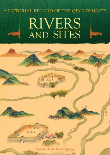
(Ebook) A Pictorial Record of the Qing Dynasty - Rivers and Sites by Tianjin Library ISBN 9789814246163, 9814246166
A Pictorial Record of the Qing Dynasty - Rivers and Sites, includes two major categories of maps: river maps and maps of historical sites.China was an agrarian society during medieval times, and harnessing rivers played an important role in sustaining social development. A Compendium on Harnessing Rivers, which was completed in the 42nd year of Emperor Kangxi s reign (1703), contains a large number of valuable pictures compiled and edited by Zhang Penghe, the governor-general in charge of rivers. The book also contains maps of various rivers drawn by anonymous artists. They record the vicissitudes of rivers and areas along the banks while at the same time realistically tracing the shapes of city walls, places of historical interest, and beauty spots along the rivers.As a mother river of the Chinese nation, the Yellow River has always been the focus of much attention, resulting in more ancient Chinese maps of this river than any other in China. This book collects many maps of the Yellow River made during the late Qing period, most of which also record in writing the dates of the crevasse and the closure of a certain section of the river and the deployment of soldiers guarding it. A Complete Map of the Yellow River within Shandong, A Map of the Yellow River within the Whole Province of Shandong, A Concise Complete Map of the Yellow River within Shandong are among the maps presented in this book.Other maps available include Maps of the Rivers under Baoding Prefecture, Maps of the Rivers under Zhengding Prefecture, and Maps of the Rivers under the Five Prefectures of Zhili Ji, Zhao, Shen, Ding, and Yi.In addition, there are three maps of historical interest: Maps of His Majesty s Temporary Dwelling Palaces on His Return Journey, Maps of Dagu Batteries, and Illustrations of Wendeng, Weihai, and Other Historical Sites..KEY FEATURES- Rivers and Sites is the third book in A Pictorial Record of the Qing Dynasty series. The other three books are entitled Business Documents (Released May 2008), Old Manchu Capital (Released June 2008), and Manchurian Railway (to be release November 2008).- Consisting of over 400 maps that appear in chronological order in ten categories, each decorated with colored drawings.- Original images and full color
*Free conversion of into popular formats such as PDF, DOCX, DOC, AZW, EPUB, and MOBI after payment.


